As you might tell from my recent posts, I’ve become map obsessed — thinking about them, looking at them, drawing them, designing a book and several broadsides. In my searches I stumbled on Nigel Peake’s Maps, a book of his drawings sub-titled “Fields, Paths, Forests, Blocks, Places and Surrounds.” The back matter says he is
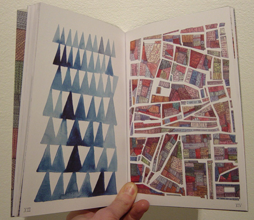
I ordered the book immediately (from a interesting shop in Edinburgh called Analogue Books). It’s full of quirky detailed drawings with wonderful names — the 2 below are called “Mountains — Ballytrustan” and “Utopian Town, Part II.” (Ballytrustan is a parish in County Down, Ireland.) And an interesting and well-written essay in the middle on mapping. Nigel has a website and blog where you can see his drawings (not restricted to maps).
Gorgeous. Thanks for sharing!
You’ve got the book open to my favorite spread!
There’s a deep-down familiarity to maps, I think, that makes maps of unknown places not only approachable but enticing even.
http://www.tinyshowcase.com/artwork.php?id=1591 More Nigel Peake
http://strangemaps.wordpress.com/
Love that Nigel Peake book. I think I’ll have to order it. Thank you for introducing him to your readers.
Awesome… I had seen his work on Tiny Showcase, but missed the fact that he published a book! Have just ordered it! Yay!