 When we returned home from Santa Fe, there was a comment on one of my recent posts about maps that said “maps are almost obsolete with GPS and all…” and that made me think about our experience navigating and learning the layout of Santa Fe.
![]() Before we left, I got a AAA map, but it required a magnifying glass to read the street names so it proved useless. From the Santa Fe tourism board, I had several sketchy maps that it turns out didn’t extend to the little casita (small short term rental in the back of someone’s house) we’d booked for the week. I printed a handful of maps + directions from Google, giving the path from the casita to various restaurants and tourist sites (these were the most useful). And I also brought our Garmen GPS system that plugs into the cigarette lighter of my car.
Before we left, I got a AAA map, but it required a magnifying glass to read the street names so it proved useless. From the Santa Fe tourism board, I had several sketchy maps that it turns out didn’t extend to the little casita (small short term rental in the back of someone’s house) we’d booked for the week. I printed a handful of maps + directions from Google, giving the path from the casita to various restaurants and tourist sites (these were the most useful). And I also brought our Garmen GPS system that plugs into the cigarette lighter of my car.
![]() I bought the Garmen several years ago because I have no sense of direction and am more apt to get lost than make my way directly to wherever I’m going. I give it a mixed review — on the plus side, I’ve always gotten where I need to go. On the negative, it can take 10 minutes to get a satellite signal at night or if it’s rainy or cloudy and worst of all, it invariably picks the dumbest route ever. Once, in San Francisco, it took me through Chinatown then the busy shopping district in Union Square, and finally asked me to make a left hand turn with a lot of traffic and no light. There had to have been a better way!
I bought the Garmen several years ago because I have no sense of direction and am more apt to get lost than make my way directly to wherever I’m going. I give it a mixed review — on the plus side, I’ve always gotten where I need to go. On the negative, it can take 10 minutes to get a satellite signal at night or if it’s rainy or cloudy and worst of all, it invariably picks the dumbest route ever. Once, in San Francisco, it took me through Chinatown then the busy shopping district in Union Square, and finally asked me to make a left hand turn with a lot of traffic and no light. There had to have been a better way!
![]() We used the Garmen the first day or 2, all the while discussing how we might learn the layout of the neighborhood where we were staying. There were lots of streets with similar names, streets that dead-ended and several more going only one way. My husband tried to identify & remember landmarks, I tried memorizing the street names.
We used the Garmen the first day or 2, all the while discussing how we might learn the layout of the neighborhood where we were staying. There were lots of streets with similar names, streets that dead-ended and several more going only one way. My husband tried to identify & remember landmarks, I tried memorizing the street names.
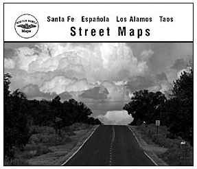
![]() Then someone we met suggested the Horton Family Maps. It’s a book of street maps of the area, and almost instantly I was able to get a big picture of the town and figure out the distance between places (the Garmen will tell me how many minutes to get somewhere, but it’s awkward to figure out how many miles). We still used the Garmen, but with the book we were able to figure out alternate routes to the inefficient ones the Garmen suggested. (The map guide is family owned and only covers Santa Fe, Taos, Los Alamos area. There’s a nice article about them here.)
Then someone we met suggested the Horton Family Maps. It’s a book of street maps of the area, and almost instantly I was able to get a big picture of the town and figure out the distance between places (the Garmen will tell me how many minutes to get somewhere, but it’s awkward to figure out how many miles). We still used the Garmen, but with the book we were able to figure out alternate routes to the inefficient ones the Garmen suggested. (The map guide is family owned and only covers Santa Fe, Taos, Los Alamos area. There’s a nice article about them here.)
![]() I must admit that I found it fascinating watching us attempt to learn to navigate a new place! What do you like to use to learn how to get around a new town?
I must admit that I found it fascinating watching us attempt to learn to navigate a new place! What do you like to use to learn how to get around a new town?