This site lets you put a map of your choice on a tie, a skirt, a lamp, a clock. Here’s the lampshade.
Maps and ways to display data are a constant source of design inspiration for me…
This site lets you put a map of your choice on a tie, a skirt, a lamp, a clock. Here’s the lampshade.
Back in February I wrote about a scrolling “watch” I ran across, pictured below. It seemed the perfect idea for a matchbox book. And it is…
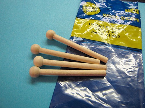
I found these tiny wooden pegs at the craft store in the doll house section

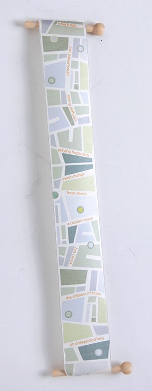
Then I designed a map

and put it in a matchbox:
See more pictures here.
I couldn’t find a bigger picture, but I was intrigued by this work by Bexx Caswell in the “Geographies: New England Book Work” show by the members of the Guild of Book Workers’ New England chapter. In the catalog she says
When I first moved to New York, I helped myself to learn the city by equating roads and neighborhoods to those I knew growing up in Philadelphia. I used a similar tactic when I moved to Boston a few years later. I soon found that as I became more familiar with the roadways of Boston, the once familiar landscapes of Philadelphia and New York became faded and distorted in my mind’s eye. Although each of the cities featured in this book have their own distinct geographies, they also share a certain sameness dictated by their location on the East Coast. Street names, landmarks, and visual landscapes all blend into one another.
To create this book, I dissected maps of Philadelphia, New York, and Boston, and then shuffled the pages so that they would be ordered randomly. I intentionally chose maps printed by the same mapmaker to encourage visual similarities. Each roadmap blends into the next, a chaotic jumble of roads, street names, and anonymous landmarks. This in not unlike the map which now exists in my mind’s eye.
See the entire catalog here.
I’ve been thinking about making a scroll for inside one of my matchboxes and ran across this contraption from the 1920s—the Rootefinder. According to this blog post,
The technology—a curious cross between the space age and the stone age—consisted of a little map scroll inside a watch, to be ‘scrolled’ (hence the word) as the driver moved along on the map. A multitude of scrolls could be fitted in the watch to suit the particular trip the driver fancied taking. The system has several obvious drawbacks—a limited number of available journeys, and the inability of the system to respond to sudden changes of direction. Also: no warning of road works or traffic jams ahead.
There’s an article about “weird and wonderful gadgets,” including this one, here.
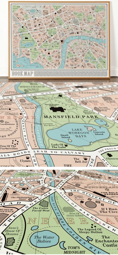
This map created by a design group called Dorothy is loosely based on a turn of the century London street map and is made up from the titles of over 600 books from the history of English Literature. It includes classics such as Mansfield Park, Northanger Abbey, Bleak House, Vanity Fair and Wuthering Heights as well as 20th and 21st Century works such as The Waste Land, To the Lighthouse and Animal Farm.

My friend Suzanne sent me a link to this kickstarter project for an ingenious map using the turkish mapfold. It starts as a square with a tiny city overview. It unfolds to two panes of mass transit. It unfolds again to four panes of the city map. She’s got maps for Berlin and London, and was trying to raise money for a map of New York City. See more on the designer’s website.